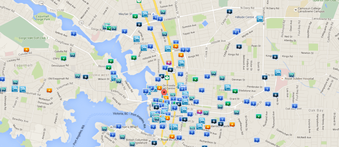
Five years after Victoria Police introduced an online map showing up to six months of crime statistics around Victoria neighbourhoods, the police force have suddenly removed access to the data from their website.
A statement on VicPD’s website says: “Crime Reports is temporarily unavailable. We’re reviewing this service to ensure it meets the needs of our community. In the meantime, we’d like to hear from you about what crime data you need and what you use it for.”
The crime-map came under fire recently when some felt the the data was not properly reflecting an increase in crime around Victoria’s tent city over the past 6 months.
On several occasions Victoria Police stated that crime has not risen in this area, but the people who live in this area strongly disagreed.
Despite the low numbers of crime showing on the crime map, members of the community say there has been an increase in police activity in and around the courthouse since the tent city formed nearly six months ago, and crime has significantly increased.
Some of the crimes include multiple stabbings, repeated reports from nearby residents of property crime and break-ins, residents being awoken through the night with suspicious activity happening outside their residences.
Some are calling the sudden shutdown suspicious after running without issue for five years.
“That kind of data should be public and easily accessible. Hopefully temporary. I’ll check,” Victoria councilor Jeremy Loveday writes on Twitter.
Victoria Buzz has reached out to Victoria Police via email and are still awaiting a response.
Although the data has been removed from the Victoria Police website, the crime map can still be viewed at crimereports.com – and appears to still be getting updated.


