
It wasn’t that long ago when you could go outside and look to the blue sky or out at the horizon and enjoy a pristine view of Greater Victoria.
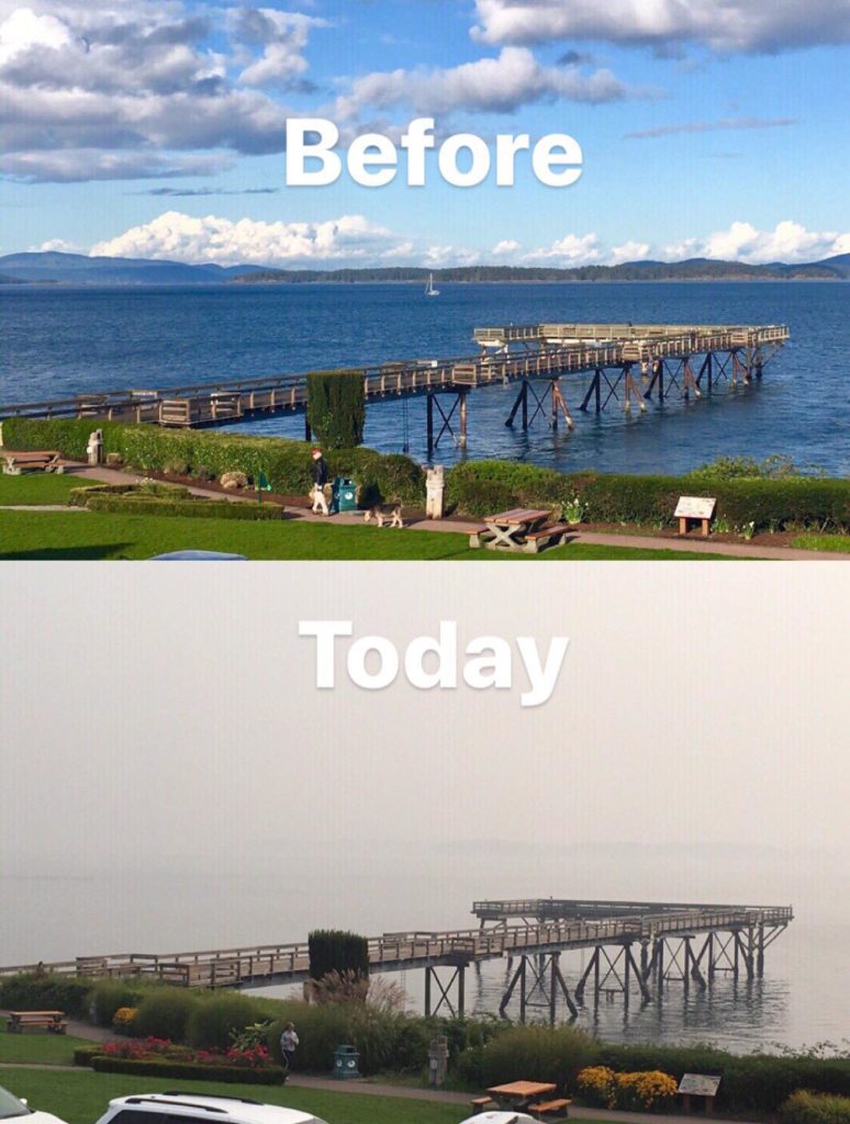
Now, 458 wildfires raging across British Columbia have left the air clouded in smoke, obscuring the landscape and turning the act of taking a breath into a health risk. The B.C. declared provincial state of emergency, and Harbour Air has even been forced to cancel flights due to poor visibility.
To paint a, um… clearer picture of just how bad things are right now, we’ve put together some photos comparing Victoria locations before and after the smoke rolled in.
Hopefully it won’t be too long before the weather works in the province’s favour and some rain comes down to put the fires out.
A new hashtag is also being used for this smoky August: #smogust

https://www.facebook.com/photo.php?fbid=10157719696688858&set=p.10157719696688858&type=3&theater
https://www.facebook.com/photo.php?fbid=10160727912650503&set=p.10160727912650503&type=3&theater

Elk Lake:
Before
Now
Dallas Road
Before
Now
Inner Harbour downtown
Before
https://www.instagram.com/p/BmylhNoA8sK/?tagged=victoriabc
Now
https://www.instagram.com/p/Bmv8Td_HOA-/?taken-at=49254
Mount Doug
Before
Now