
While the wildfires in B.C. forced the government to declare a provincial state of emergency this week, information from Natural Resources Canada shows just how widespread the danger of fire actually is.
The Canadian Wildland Fire Information System collects information on daily weather conditions across the country to produce fire weather and fire behaviour maps.
An interactive map of the country’s fire danger shows the majority of B.C. is at a high to extreme level of risk.
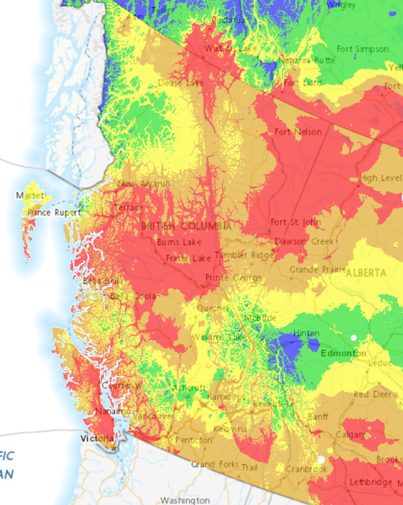
Most of the high-risk areas are in the northern and interior parts of the province, though the majority of Vancouver Island and parts of the mainland also show similar levels.
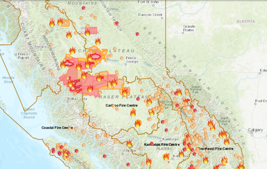
The findings correlate to some extent with the locations of several active wildfires, based on BC Wildfire Service’s own map of the province.
See also:
- Evacuation alert issued for Vancouver Island village due to wildfire (PHOTOS/VIDEOS)
- B.C. government to match Red Cross donations for people affected by wildfires