
Things are about to get chilly again.
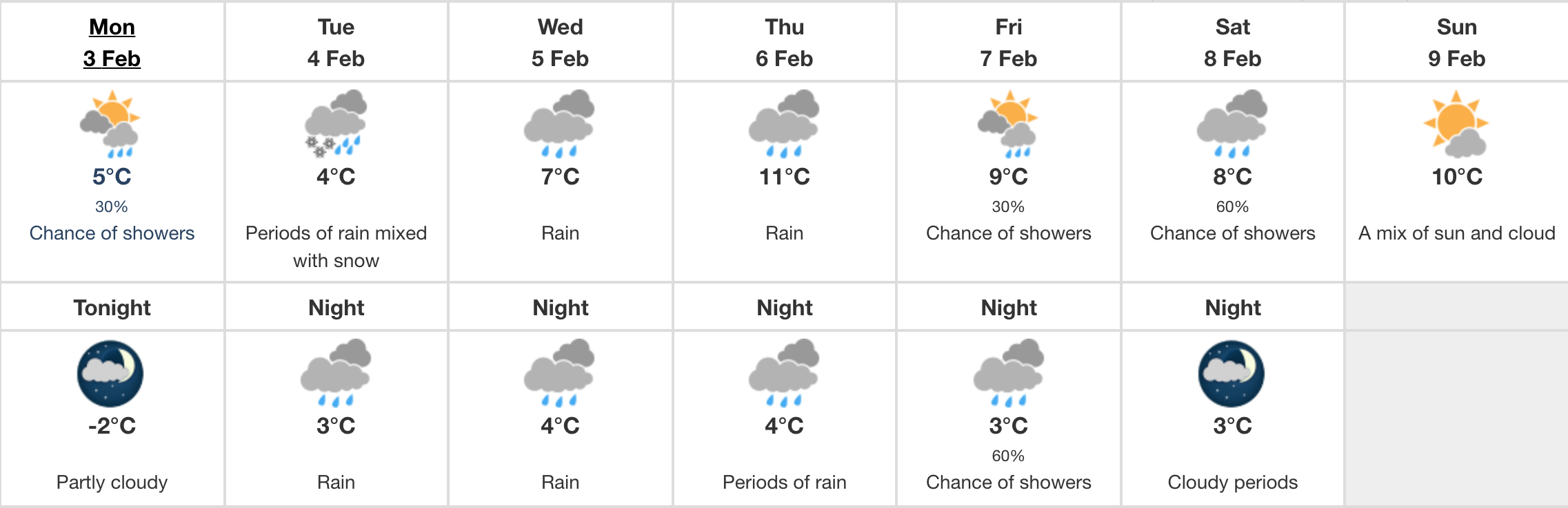
Environment Canada has issued special weather statements for parts of Vancouver Island that could see anywhere between 5 and 20 cm of snow on Tuesday.
The advisory is in effect for eastern Vancouver Island from Courtenay to Campbell River, Duncan to Nanaimo, and Nanoose Bay to Fanny Bay, and inland Vancouver Island.
“A front will track down the BC coast beginning Tuesday morning and combine with a cool airmass to produce snow across the lowlands,” says the weather authority.
“The air will be cool, but not truly Arctic, so snowfall amounts will vary with proximity to the water, elevation and intensity of precipitation.”
Get those snow shovels out again – SNOW🌨️ is coming to the south coast tomorrow! 5-20 cm of heavy, wet snow is expected to fall as a system approaches from the northwest.
A Special Weather Statement is in effect: https://t.co/Bwt6niAvPG#BCStorm @TransLink @DriveBC @TranBC pic.twitter.com/2wGTmLOb2e
— ECCC Weather British Columbia (@ECCCWeatherBC) February 3, 2020
Snow is expected to persist the longest in Metro Vancouver and Fraser Valley, but warmer air will arrive on Vancouver Island by Tuesday afternoon, causing the snow to turn into rain.
No weather advisory is in effect for Greater Victoria, which is expected to see periods of mixed rain and snow on Tuesday morning.
Data taken from Victoria Gonzales Point weather station show that the mix of snow and rain will transition in to rain by the evening, with winds picking up by early afternoon.