
Colder temperatures and even potential snowfall are on their way to Vancouver Island much earlier than usual this year.
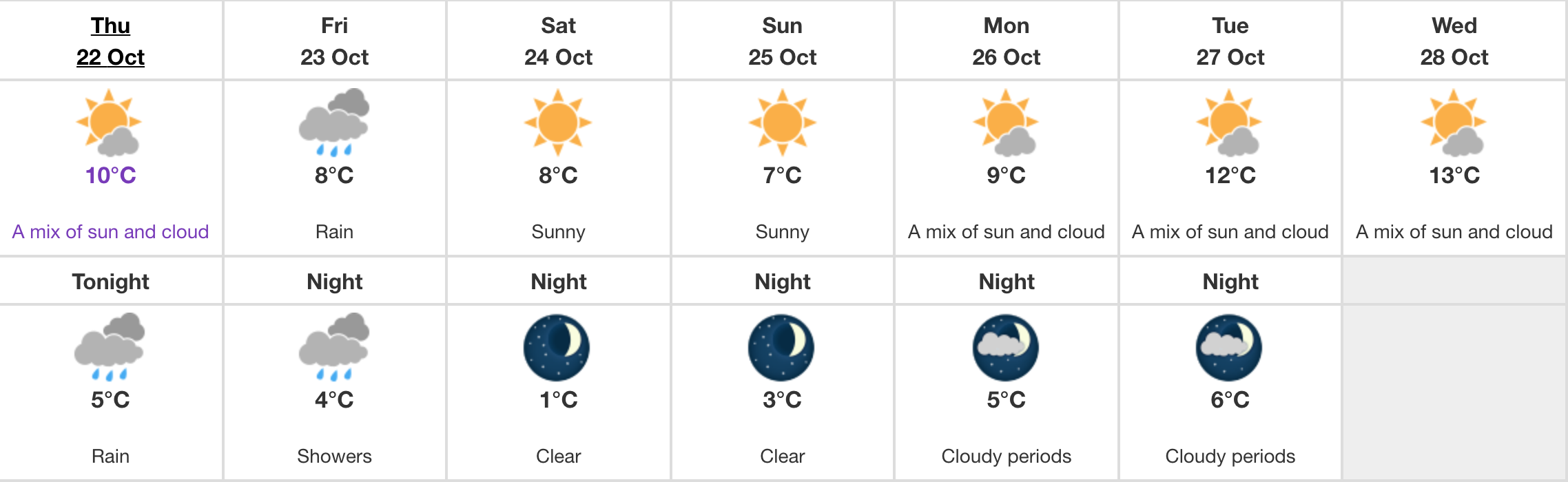
Environment Canada has issued special weather statements for north, east, and inland Vancouver Island, warning residents of early season snowfall in the region starting tonight and continuing throughout the weekend.
According to the statement, a modified Arctic airmass is expected to arrive on the coast possibly Thursday night and Friday morning.
The low pressure system will pass just off Vancouver Island Friday morning and move onto the Washington coast by evening.
The combination of colder temperatures and onset of precipitation means there’s a chance of snowfall creating tricky driving conditions for Highway 19 between Campbell River and Port Hardy, Highway 28 to Gold River, and Highway 4 between Coombs and Port Alberni.
The weather authority says a few centimetres of snowfall is possible Friday morning, which will then become mixed with snow by afternoon.
“The system will move out of the region Friday evening but a cold airmass settling in behind the system will ensure temperatures remain 5 to 8 degrees below seasonal normals,” reads the Environment Canada statement.
Victoria can also expect these unseasonably cold temperatures, which are expected to dip to 7ºC during the day this weekend and reach nighttime lows of 1ºC Saturday night.
All in all, it might not be a bad idea to crank up the heaters and break out the winter jackets early this year.