Prepare yourself for a road trip back through time!
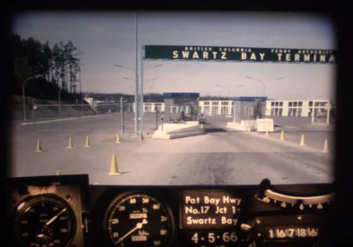
While dashcams are a relatively new invention, the BC Ministry of Transportation has just released footage of a driver from 1966 travelling from Victoria to the Swartz Bay ferry terminal.
The footage was captured by rigging a camera onto the dash of a car that took still images every 80 feet. The images were then strung together into a single roll of film.
Besides the vintage speedometer and dashboard, Victorians may recognize familiar areas in the video.
The footage starts on Blanshard Street (at the time called East Saanich Road) then transitions onto more rural streets near the Swan Lake/Christmas Hill area. The car then travels along Quadra Street, crossing McKenzie Avenue towards Royal Oak before moving onto the highway, where the Quadra Street overpass currently stands.
Around the 0:36 mark, the video shows the junction of Highway 17 and 17A (also known as West Saanich Road) which leads towards Butchart Gardens.
Then, at roughly the 1:47 mark, viewers can see an uninhabited section of the Patricia Bay highway at the Island View intersection.
In 1966, the area was simply empty fields; fast forward to 2019, and the intersection is marked by Michell’s Farm and the popular Lochside Drive biking trail.
See also: Check out this skateboarding video of Esquimalt back in the mid-70s! (VIDEO)
The video then continues past the exit to Sidney all the way up to the Swartz Bay ferry terminal, where construction of the road at the time was not yet complete.
As the car travels north up the highway, viewers may also notice a distinct lack of traffic lights at intersections along the Pat Bay.
Victoria sure has grown in the 53 years since the footage was recorded.
Check it out below:


