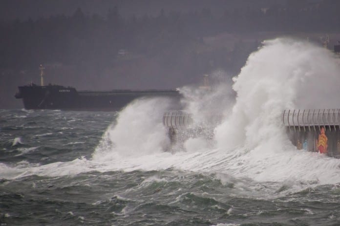
A wind alert has been issued for Greater Victoria ahead of expected snowfall this week.
Environment Canada has issued an advisory regarding a frontal system evolving over the Pacific Ocean, poised to reach the BC coast imminently.
According to the weather agency, southeasterly winds of 30 km/h with gusts up to 50 km/h as the system draws near.
These winds are expected to shift direction overnight, turning westerly and gradually intensifying through Tuesday morning.
Projections indicate westerly winds reaching speeds of 70 km/h with gusts of up to 90 km/h along coastal areas.
By early Tuesday afternoon, the winds are predicted to ease below the threshold for a warning, first in the southern Gulf Islands and later in Victoria, as the system commences its departure from the region.
Environment Canada are advising residents and travellers to remain vigilant, especially in coastal zones, as the winds are forecasted to fluctuate and gradually diminish as Tuesday progresses.
As a polar vortex sweeps over British Columbia, Vancouver Island is poised for a significant drop in temperatures as the week progresses.
On Sunday, Environment Canada issued a special weather statement, warning of substantial snowfall in inland areas of the central and south coasts.
In addition, the statement suggests the potential for snow at sea level along the coastal regions of the south coast and eastern Vancouver Island, followed by heavy rainfall—western and southern Vancouver Island will also experience very strong winds.
As of this publication, Environment Canada is predicting snowfall to begin on Thursday and will continue through until at least Monday.
Temperatures are expected to drop to the minus category by Thursday with lows hitting -6°C on Friday.
In addition to the above warnings, another Environment Canada is warning of elevated ocean water levels accompanied by significant waves are expected, likely exceeding highest astronomical tide.
Large waves due to gale-force southwest winds, storm surge and seasonably high tides have the potential to produce high water levels for Tuesday.
Coastal flooding is possible along exposed shorelines, especially in low-lying areas.
Areas impacted include shorelines along the Strait of Juan de Fuca, including Sooke and Victoria, Southern Gulf Islands, areas near Boundary Bay within Metro Vancouver.
Exceptional precipitation rates inland Vancouver Island. Do not travel along Highway 28, the S2S, or portions of 19 north of Campbell River through Tuesday am. #BCStorm pic.twitter.com/tk5bJ8Sl01
— Tyler Hamilton (@50ShadesofVan) January 8, 2024


